Built for Australian waters

Every catch tells you when to go back.

LureMark logs your fish with the exact tide, wind, pressure, moon and river level at the moment you landed it — then reads the wind map, the dam levels and your own history to tell you when to go again.

Free plan, no card. Runs in any browser and installs to your home screen today.

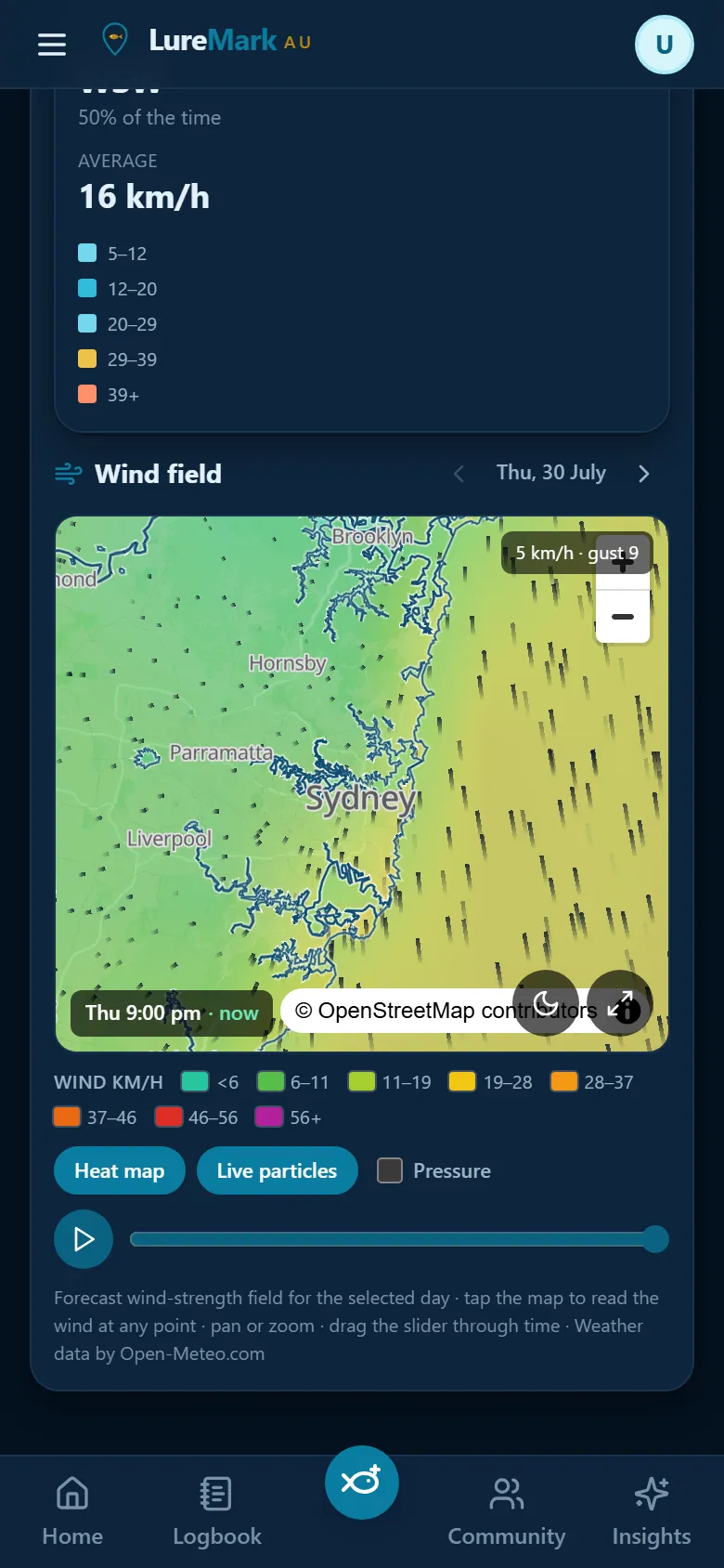
LureMark wind map: a colour wind-strength field with flow arrows over Sydney
Wind mapscreenshot
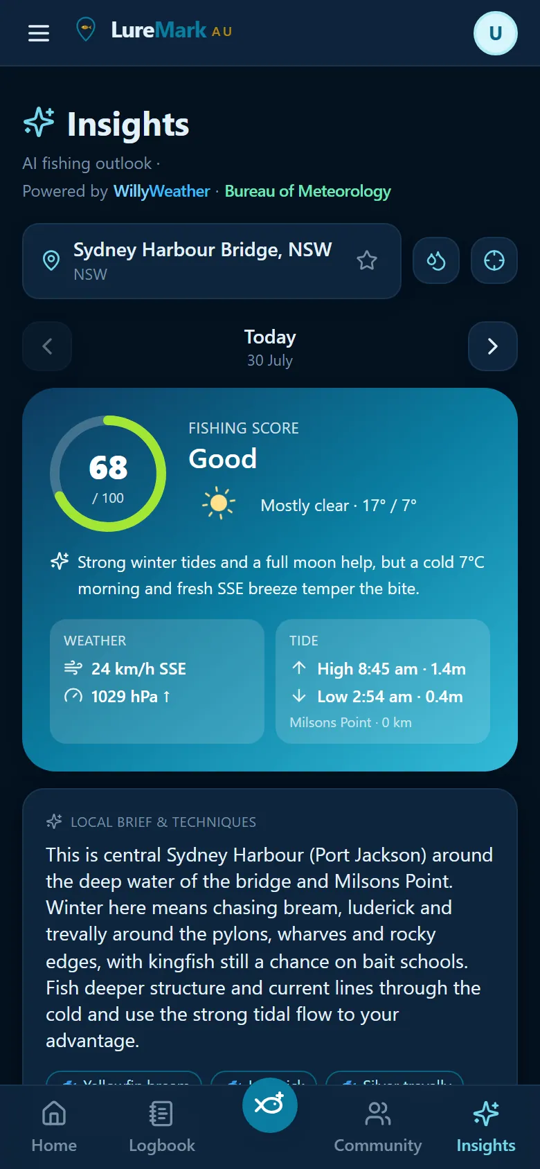
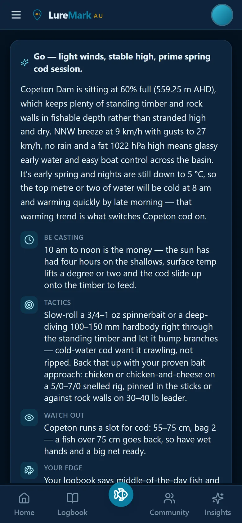
LureMark Insights: a fishing score of 68 out of 100 with the AI rationale for Sydney Harbour
Insightsscreenshot
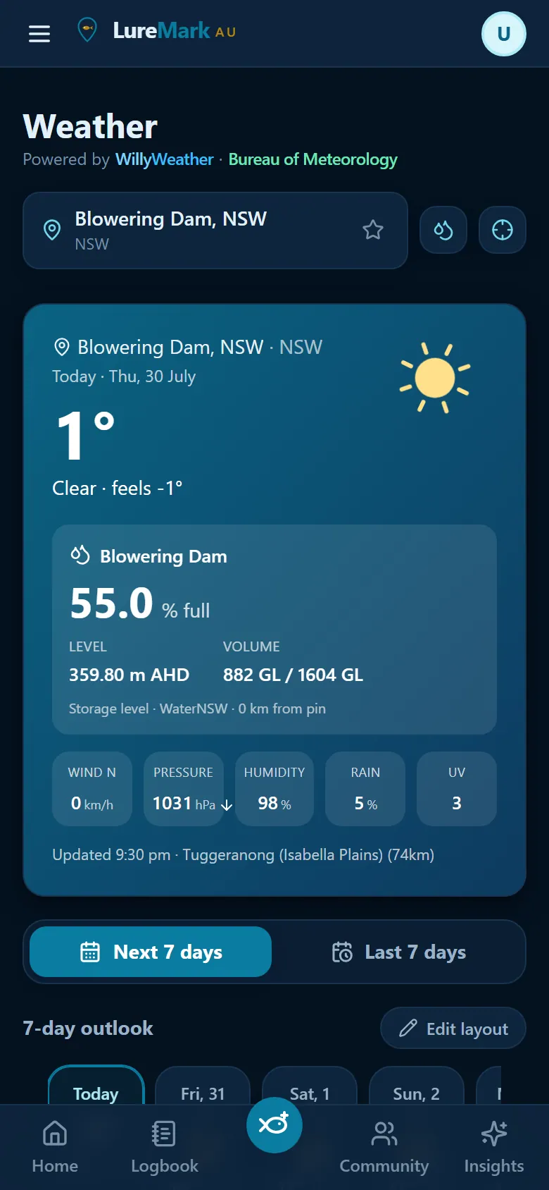
LureMark freshwater panel: Blowering Dam at 55 percent full with level and volume
Dam levelsscreenshot
Bureau of Meteorology radar BoM river height & flow gauges WillyWeather tides & warnings Open-Meteo marine forecasts G-MW · WaterNSW · SunWater Seqwater · Hydro Tasmania · SRW Blue-green algae alerts
See the app

Twelve screens, no fluff

Swipe through the real thing — the same app you'll be holding on the water.

Insights: a fishing score of 68 out of 100 with the AI rationale
Bite scorescreenshot
Bite scoreWhy today is or isn't worth the fuel
Wind map: colour wind-strength field with flow arrows over Sydney
Wind mapscreenshot
Wind mapHeat field + live flow, scrubbable by hour
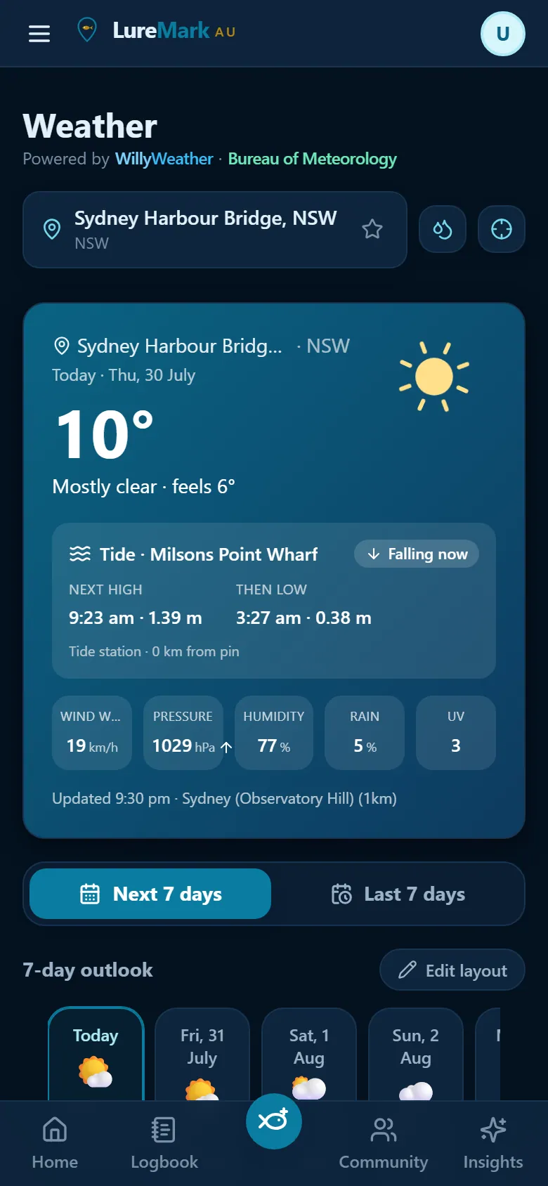
Weather hero: temperature, live tide state, wind, pressure and UV
Today at a glancescreenshot
Today at a glanceLive tide state, wind, pressure, UV
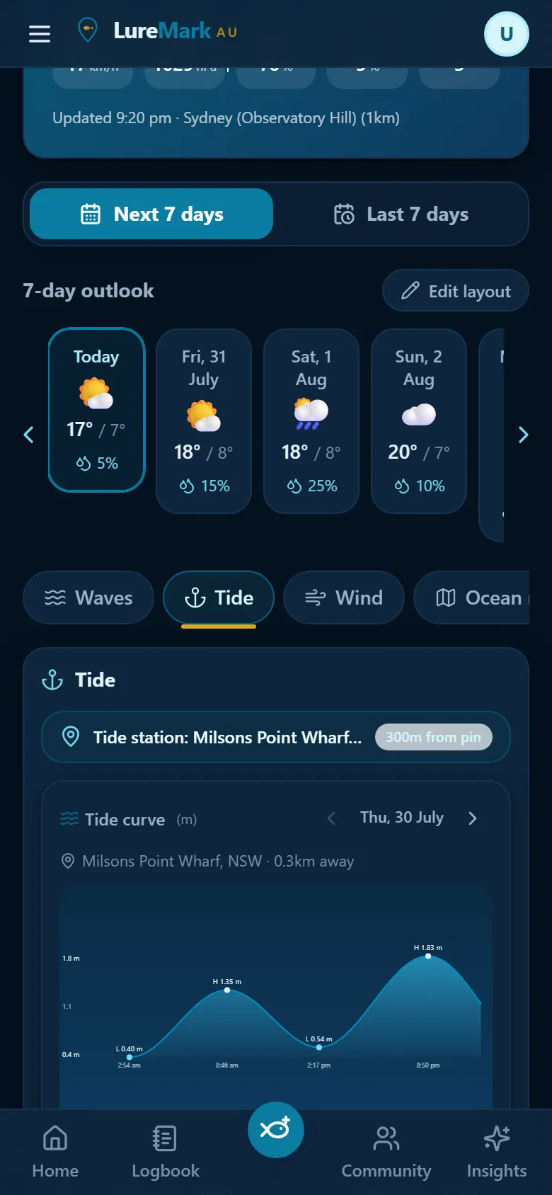
Interactive tide curve with high and low markers for Milsons Point
Tidesscreenshot
TidesReal curve, real station, drag to scrub
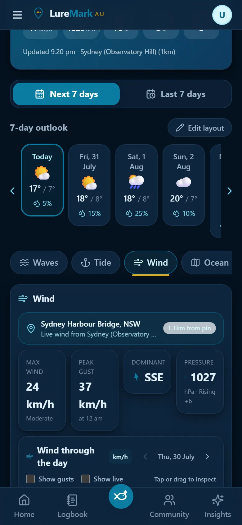
Wind pane: max wind, peak gust, dominant direction and pressure trend
Wind detailscreenshot
Wind detailMax, gusts, direction and pressure trend
Waves pane: swell height, period and direction with a compass rose
Waves & swellscreenshot
Waves & swellHeight, period and direction at your pin
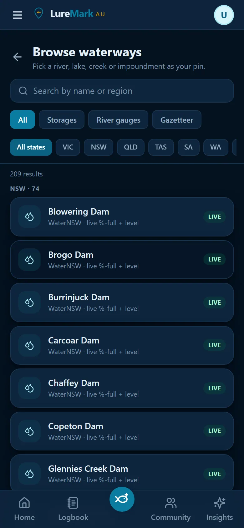
Browse waterways: 209 Australian rivers, lakes and dams with LIVE badges
Waterwaysscreenshot
Waterways209 rivers, lakes and dams — LIVE where they report
Blowering Dam at 55 percent full with level and volume from WaterNSW
Live dam levelsscreenshot
Live dam levels%-full, level and volume, straight from the agency
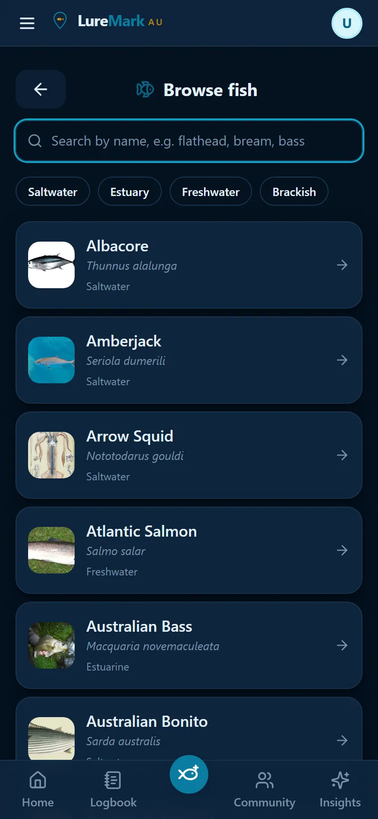
Species catalogue with reference photos for Australian fish
Species guidescreenshot
Species guideEvery AU species, with photos and rules
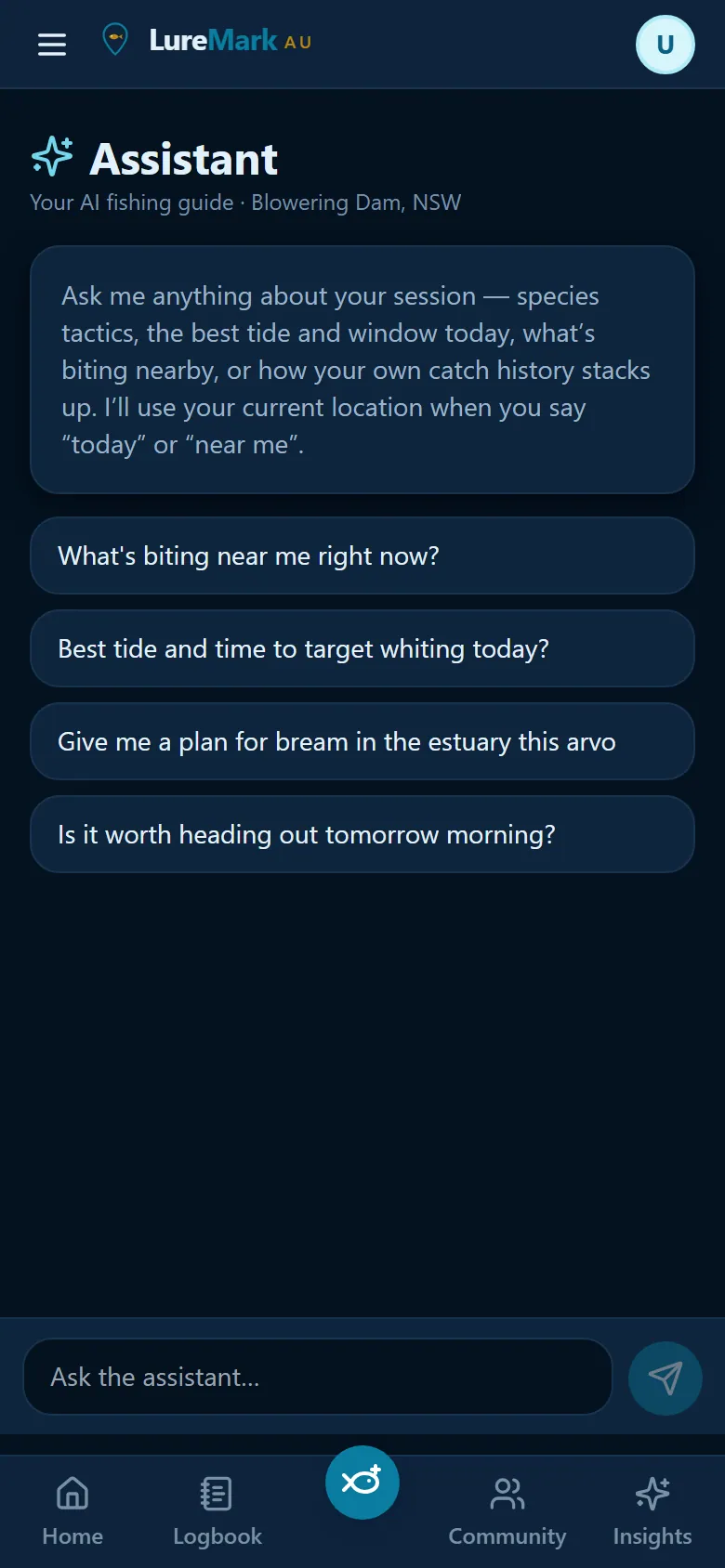
Fishing Assistant chat with suggested questions
Assistantscreenshot
AssistantAsk it anything about your session
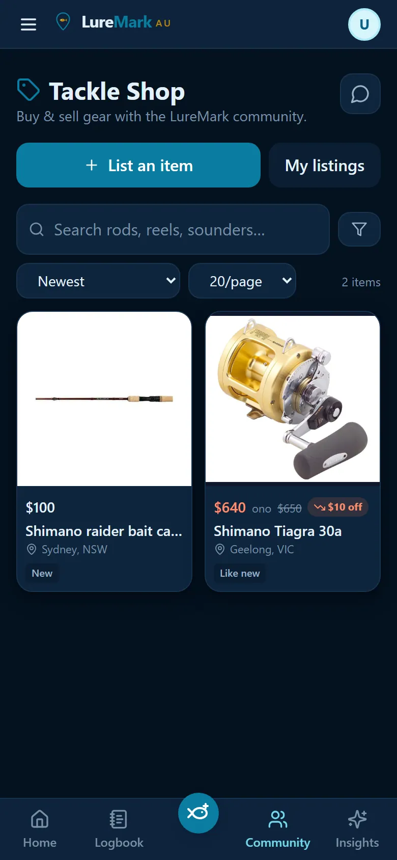
Tackle Shop listings for a Shimano rod and reel
Tackle Shopscreenshot
Tackle ShopBuy and sell gear, angler to angler
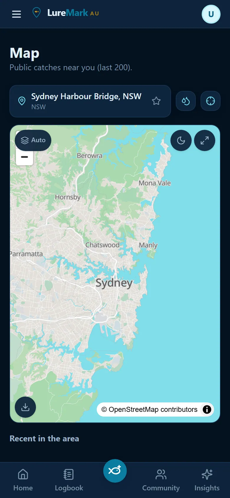
Map of public catches near Sydney with an offline download button
Maps & offlinescreenshot
Maps & offlineDownload the area before you lose signal
Built from a lifetime on the water

Made by an angler who wanted to remember every good day.

LureMark began with a simple frustration: the details that make a fishing trip work are scattered across photos, notebooks, weather apps and half-remembered stories.

Fishing has been part of the developer's life for as long as he can remember. His father fished, and his grandfather before him. Growing up around the tackle and recreational fishing industry meant learning that a good day is rarely luck alone — it is water, weather, timing, gear and the little things you only notice after years on the water.

From fly fishing small streams to chasing Murray cod through lakes and rivers, then bay fishing and hunting pelagic game fish offshore, every kind of trip left useful clues behind. LureMark puts those clues in one place: your catch history, the conditions on the day and the local information that helps you decide where to go next.

It is also made for the people you fish with — a friendly competition, the family chat, a local angling club or a private group sharing catches without giving away every spot.

What you get

A fishing log that actually does the thinking

Most apps ask you to type what the weather was. LureMark already knows — and remembers it for every fish you land.

Log a catch in under a minute

Photo → species → size → method → done. Temperature, wind, gusts, pressure, humidity, water temp, swell, tide stage and moon phase are captured automatically. Photo EXIF fills in where and when if you're logging it later.

MultiCatch for a hot session

On a whiting or bream run, log the whole session at once — one shared spot and conditions snapshot, a length and weight row per fish, one tap to commit the lot.

AI Fish ID that knows AU species

Snap the fish and get the three most likely Australian species with a confidence score. Wrong? A short guided Q&A narrows it down — and your correction sharpens the model for your local water.

Ask the Fishing Assistant

"What should I throw at Wivenhoe this arvo?" It answers from your location, the live forecast and your own history — and quotes the real size, bag and closed-season rules for your state instead of guessing.

A 0–100 bite score, seven days out

An instant heuristic score from wind, swell, moon and time of day, then an AI brief that streams in with the rationale, species to target, gear and the best window. Plan the weekend on Wednesday.

A dashboard you arrange yourself

Drag, resize or hide every panel — tides, wind, waves, rain, sun and moon, river levels. Scroll or tabs, next 7 days or last 7, and a saved layout per waterbody type so coastal and freshwater each look right.

Your spots — offline

Mark spots, download the map tiles before you leave range, and navigate back to the exact metre where you hooked up. Catches logged with no signal queue on the device and sync themselves later.

Comps, clubs and leaderboards

Run a competition with live standings, share catches with friends or a group only, and climb the 30-day and all-time boards against the people you actually fish with.

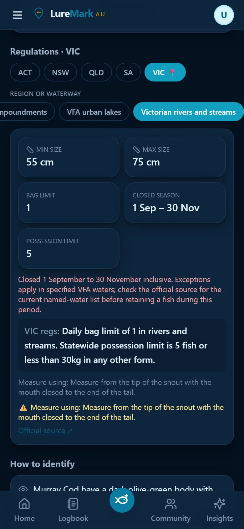
Rules for where you are

Under-size, slot-limit and closed-season warnings are flagged by where the fish was caught, not where you live — so an interstate trip doesn't cost you a fine. Official source linked every time.

Wind map

Watch the wind before you hitch the boat

A forecast wind field painted straight onto the map: a colour heat layer for strength and a live particle flow showing exactly where it's coming from. Scrub the day forward and see the sea breeze arrive.

  • Heat map + animated particles, each toggleable — your choices are remembered
  • Optional pressure-gradient overlay for reading the change before it lands
  • Tap anywhere on the water for speed and direction at that point
  • Per-day time scrubber, and the field follows you as you pan and zoom
  • "Show live" overlays observed wind from nearby stations against the forecast
  • Hourly wind on every data point plus a compass rose, if you'd rather read numbers
LureMark wind map showing the wind-strength field and flow arrows over Sydney, with heat map and live particle toggles
Wind mapscreenshot
LureMark freshwater panel: Blowering Dam 55.0% full, level 359.80 m AHD, volume 882 of 1604 GL, sourced from WaterNSW
Dam levelsscreenshot
Waterways & gauges

Know the dam level before you drive four hours

LureMark pulls live readings straight from the agencies that publish them, so inland spots get the same treatment the coast gets from tide charts.

  • Dam and lake %-full, level and volume from G-MW, WaterNSW, SunWater, Seqwater, Hydro Tasmania and SRW
  • River height, flow and 24-hour trend from Bureau of Meteorology gauges
  • Real 7-day history charts for level, volume and water temperature
  • Browse 200+ named AU rivers, lakes and dams, with a LIVE pip on the ones reporting now
  • Several live waterways near your pin? Switch between them with one tap
  • Blue-green algae alerts and BoM warnings surface as a banner, not a footnote
Swell, rain & radar

Know what the water will be doing

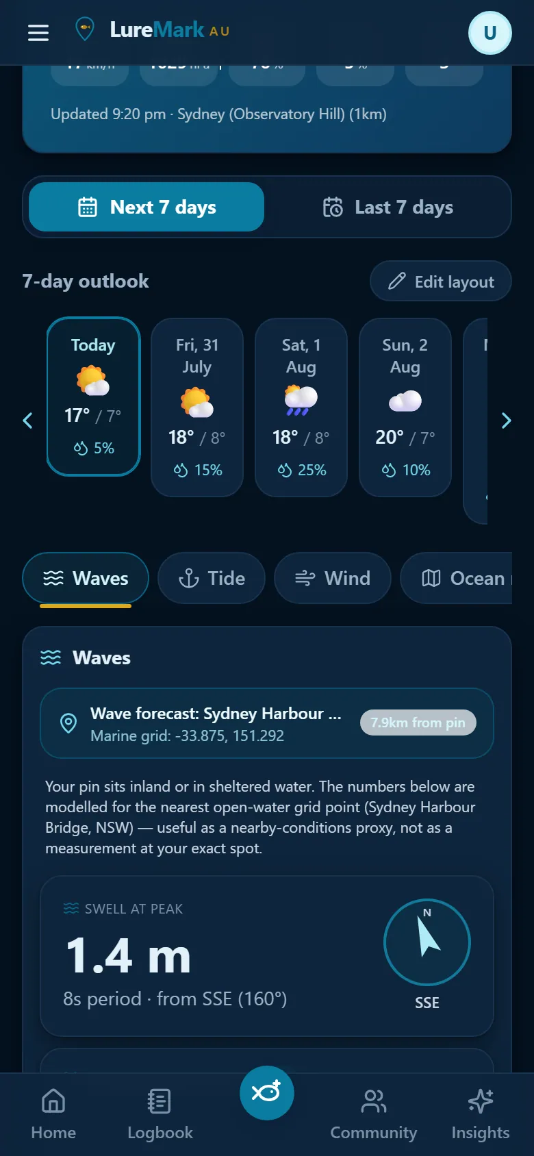
Swell height, period and direction, wind-wave height and sea state — and when the pin sits in sheltered water, it says so plainly instead of pretending the open-ocean number is yours.

  • Rainfall plus the BoM national and local composite radar, with a scrubbable timeline and a fullscreen loop for the drive down
  • Satellite, lightning and synoptic charts for reading the pattern, not just the hour
  • Severe-weather warnings for the exact pin you're looking at
  • Sun and moon: rise, set, phase and illumination, calculated on-device so it works offline
LureMark waves pane: 1.4 m swell at peak, 8 second period from the SSE, with a direction compass
Wavesscreenshot
LureMark Tackle Shop listings: a Shimano bait caster in Sydney and a Shimano Tiagra 30a in Geelong
Tackle Shopscreenshot
Tackle Shop

Sell the reel you never use to someone who will

A marketplace for Australian anglers, built into the app you already log your catches in — rods, reels, lures, soft plastics, electronics and the rest, angler to angler.

  • List in a couple of taps: photos, condition, price, and your rough area
  • Browse and filter by category, condition and distance from you
  • Message the seller in-app — contact details are scrubbed until you choose to share them
  • Free plan puts one listing in circulation a month; Pro sells as much as you like
  • Boats and kayaks are next on the roadmap
How it works

Three taps today, an edge every trip after

Log what you catch

Snap a photo and confirm the species. LureMark stamps the spot and every condition around it — no notebook, no guessing later.

Watch your patterns appear

Your best tide phase, time of day, go-to technique and the species you land bigger than average, drawn from your own log once there's enough of it to trust.

Get told when to go

A daily bite score for your spot with the reasoning, the species to target, the gear to bring and the window to be there — up to seven days ahead.

Native apps

iPhone and Android builds are on the way

The full app already runs in your browser and installs to your home screen — offline maps, camera, GPS and push notifications included. Native App Store and Google Play builds are in development; put your email in below and you'll hear the day they land.

Coming sooniOS · App Store Coming soonAndroid · Google Play

Use it free in the browser right now — nothing to wait for.

Pricing

Free to fish. Pro when you're serious.

Every account starts with a 7-day Pro trial — no card up front. Keep using the free plan for as long as you like.

Free

$0
forever
  • Up to 30 catches and 5 saved spots
  • Full weather, tides, wind, waves and river data
  • AI Fish ID and the Fishing Assistant on a light allowance
  • Rain radar once a day
  • One Tackle Shop listing a month
Create an account

Pro

See in app / month
cancel any time
  • Unlimited catches, spots and saved locations
  • Unlimited AI Fish ID, Assistant and Insights briefs
  • Radar, satellite, lightning and synoptic maps on demand
  • Offline map downloads and competition hosting
  • Unlimited Tackle Shop selling
Start the 7-day trial
FAQ

Questions anglers actually ask

Is it on the App Store or Google Play?

Not yet — native iOS and Android builds are in development. In the meantime LureMark runs in your browser and installs to your home screen in two taps, where it behaves like any other app: full screen, offline, camera, GPS and push notifications.

Does it work where there's no reception?

Yes. Download your map area before you leave, and log catches as normal — photos and all. Everything queues on the device and syncs the moment you're back in range, without duplicating anything.

Which dams and rivers have live data?

Around 33 fishable impoundments report level and %-full through G-MW, WaterNSW, SunWater, Seqwater, Hydro Tasmania and SRW, and about 25 fishable river gauges report height and flow through the Bureau of Meteorology. Behind those sits a curated list of 200+ named waterways, so your spot is findable even when nobody publishes a gauge for it.

Can other people see my spots?

Your spots stay private. You can choose to share catches with selected friends or groups, while keeping the exact location to yourself. Any nearby-angler information is aggregated and anonymised, so a single catch never becomes a pin on someone else's map.

How does the Tackle Shop handle payment?

It doesn't, yet — listings connect a buyer and a seller who settle it between themselves, the way a local classifieds does. Contact details stay scrubbed until you share them. Integrated payments are on the roadmap.

Is the AI going to tell me something wrong about the rules?

Size, bag and closed-season answers come from a maintained per-state regulations table with a link to the official source, and the assistant is barred from answering those from memory. If there's no verified rule for your state it says so and points you at the authority. Always confirm with your state fisheries body before you keep a fish.

Who's behind LureMark?

LureMark is being built by a lifelong angler, shaped by three generations of fishing and time spent across freshwater, bays and offshore waters. It is designed around practical fishing experience, with feedback helping shape what comes next.